What's included
13 datasets in every report
Each neighbourhood report pulls together official and modelled sources, anchored to your exact address.
🧑🤝🧑
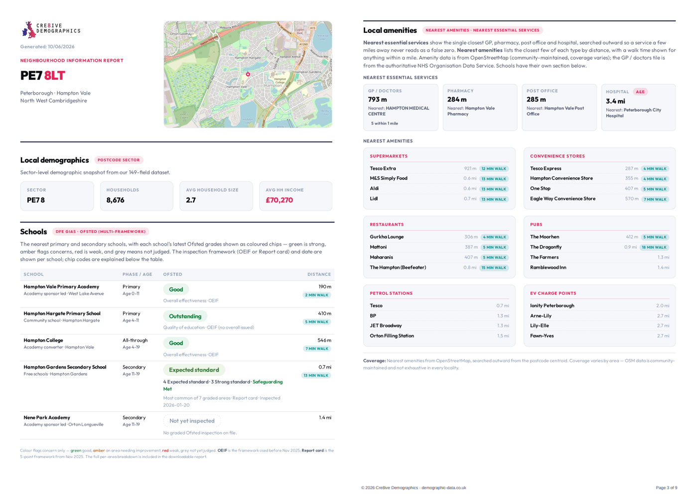
Local demographics
Full demographic profile for the surrounding sector, benchmarked against the national average.
💷
Sold prices
Recent sold prices for the street and surrounding sector.
🏛️
Council & constituency
Local authority and parliamentary constituency for the address.
🚨
Recent crime activity
Police-recorded crime by category for the latest reporting period.
🌊
Long-term flood risk
Environment Agency long-term flood-risk classification.
🎓
Schools + Ofsted ratings
Nearby primary, secondary and all-through schools with Ofsted ratings.
🩺
GP practices (NHS ODS)
Nearest GP practices from the NHS ODS directory.
🚌
Public transport (NaPTAN)
Nearest bus and rail stops to the address.
🛒
Local amenities (1 km)
Supermarkets and key amenities within 1 km of the address.
📶
Broadband & mobile coverage
Ofcom broadband and mobile coverage for the area.
📈
Affluence & deprivation
Index of Multiple Deprivation decile for the neighbourhood.
🌬️
Air quality
Modelled NO₂, PM2.5 and PM10 for the surrounding 1 km area.
🔊
Environmental noise
Major-road environmental noise modelling.