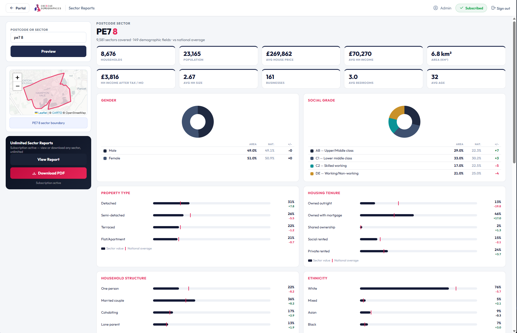
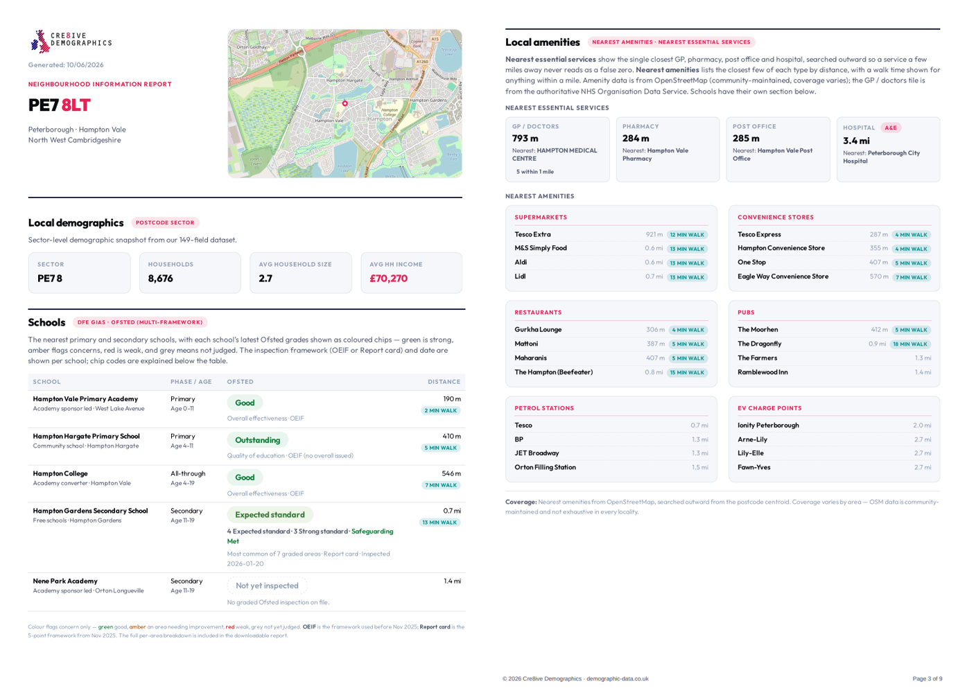
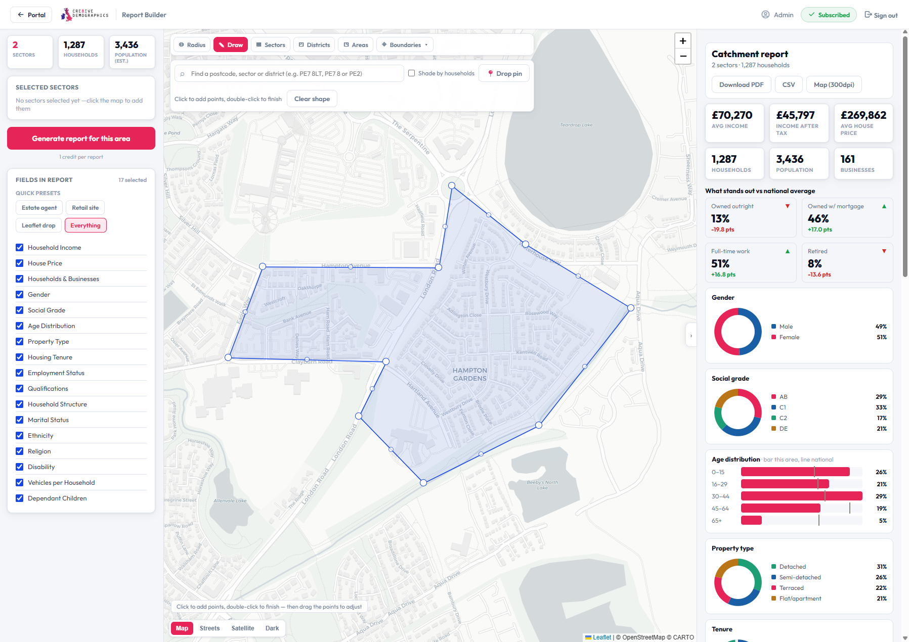
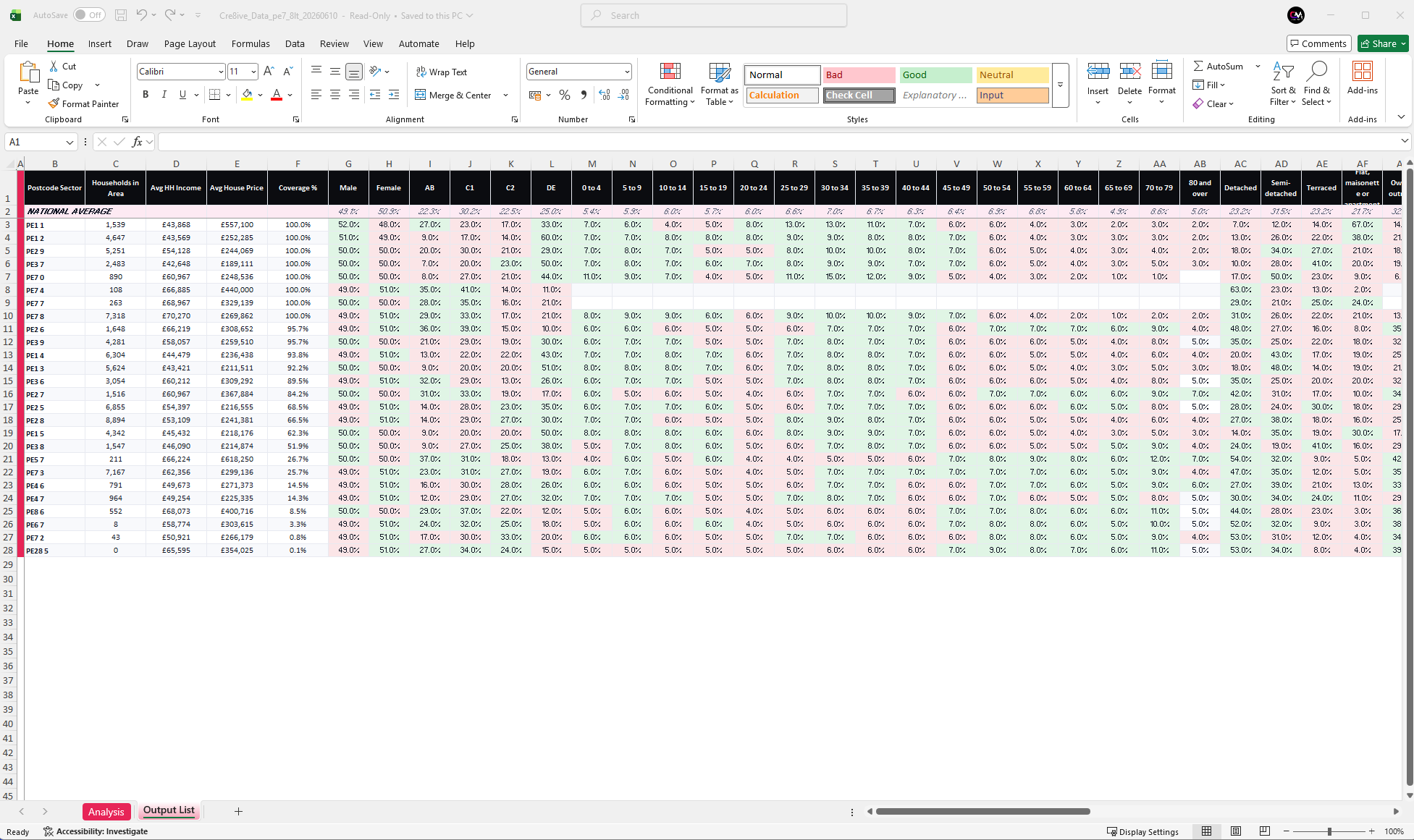
Drive time reports, postcode sector demographics, GIS mapping, and audience profiling — precise UK data for smarter marketing decisions.

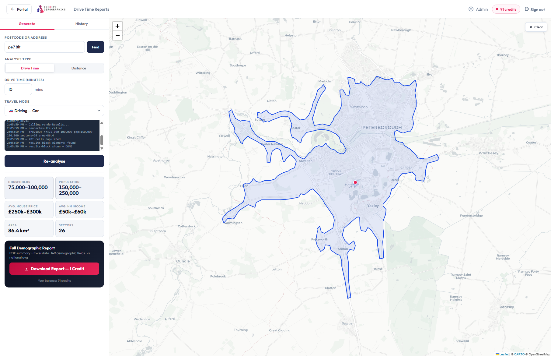
Profile the population within any drive-time, distance or public-transport catchment. Exact household counts from address-level data — the precision of manual GIS, generated in under a minute.
Explore drive time reports →
A complete demographic profile for any single postcode sector, every figure benchmarked against the national average so you can see instantly how an area over- or under-indexes.
Explore sector reports →
Street-level demographic and property reports built for estate agents — buyer profiles, tenure, house prices and household make-up around any address, ready to share with vendors.
Explore neighbourhood reports →
Choose exactly the data points and sections you need, draw or define the area yourself, and generate a tailored PDF and Excel pack on demand — no two reports need look the same.
Open the report builder →
The full demographic dataset for every UK postcode sector — up to 95 fields across England, Scotland, Wales and Northern Ireland. Download the complete 2026 master file or individual sectors.
Browse the dataset →Pay as you go for the odd report, or subscribe for unlimited downloads when you are profiling areas every week.
One-off Sector and Neighbourhood reports. No commitment - buy a single report whenever you need it.
See report pricing →Unlimited Sector or Neighbourhood reports while you subscribe. Monthly or annual - cancel anytime. Annual saves two months.
View subscriptions →Drive Time and catchment reports run on credits - the bigger the pack, the lower the per-report price. Shared across your whole company.
See credit packs →From independent retailers to national chains — our data powers smarter decisions across every sector.
Profile the catchment around every branch and new development to target the right buyers and sellers. Understand house prices, tenure and household make-up street by street.
Assess the customer profile and spending power of a site before you sign a lease. Compare drive-time catchments across multiple locations to pick the strongest pitch.
Build precise audience segments for direct mail, door drops and geo-targeted media. Back every plan with 95 demographic fields for each postcode sector you target.
Plan services, consultations and regeneration around real population data. Identify under-served communities using age, deprivation and housing-tenure profiles.
Site clinics, pharmacies and care services where demand is genuinely highest. Model catchment populations to support commissioning and capacity planning.
Target the right households for mortgages, savings and insurance products. Use income, social grade and savings indicators to sharpen your acquisition strategy.
Up to 95 demographic fields per report — and coverage varies by area. Run any postcode sector through the checker to see exactly what's available before you buy.
Get UK demographic, drive time and catchment data in minutes.
No setup. No commitment.