
Sale!
Local Authority Postcode Lookup
£90.00 Original price was: £90.00.£70.00Current price is: £70.00. +vat
Full Postcode List enabling to you cross reference any UK postcode with the Region Name, Local Authority, Ward, Parliamentary Constituency Name and European Electoral Region Name.
Product Description
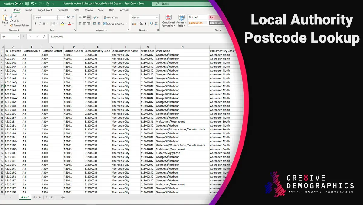
The Postcode lookup list for Local Authority Ward & District contains data that is sourced from both Royal Mail and the Office for National Statistics (ONS).
This lookup list will enable to you cross reference any UK postcode with the Local Authority, Ward, Region Name, Parliamentary Constituency Name and European Electoral Region Name.
The database is supplied in excel format and due to the number of rows of data it is spread out over 3 sheets within the file. If you would prefer to receive this in one complete MS Access document please let us know.
To allow easy filtering and search you will also find the Postcode Sector, Area and District listed so that you can view all postcodes within the one defined area.
Delivery is instant once purchased and the report will be available for download from the My Account section of this website.
Data Contained
- Full Postcode
- Postcode Area
- Postcode District
- Postcode Sector
- Local Authority Code
- Local Authority Name
- Ward Code
- Ward Name
- Parliamentary Constituency Code
- Parliamentary Constituency Name
- European Electoral Region Code
- European Electoral Region Name
- Date Introduced
Please note due to the amount of data in the file the size is over 100mb so please ensure that you are on wifi when downloading.
| Licensing | The Postcode lookup list for Local Authority Ward & District is licenced to be used by yourself or individuals within your company to be used for 1 year only and is not to be sold on. |
|---|---|
| Reference | Contains OS data © Crown copyright and database right 2021 |
| Last Update | December 2021 |